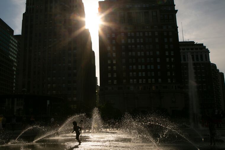
Philly had its hottest day of the year, but it’s about to get hotter, and nights won’t be much cooler
More storms are expected Thursday, and while they might take the edge off the heat temporarily, they might even add to the discomfort. Then it's going to get really hot.

After experiencing its hottest day of 2019 on Wednesday, when the official high reached 95 and the heat index soared to 104 in Philadelphia, the region might be about to experience some of its warmest nights on record.
Showers and downpours wrung out from the remnants of Tropical Storm Barry that have set off flooding in South Jersey and a general flood advisory throughout the region kept temperatures from reaching 90 on Thursday. The air, however, is again saturated with a shirt-soaking, oppressive broth of water vapor, and some of that got wrung out in downpours..
Then, heat indexes during the weekend could reach as high as 115, says the National Weather Service, which has continued its excessive-heat warning through Sunday.
For the first time this year, the City of Philadelphia, which over the last 25 years has been among the most aggressive in the nation in responding to heat waves, declared a full-blown “heat health emergency” on Wednesday.
That designation sets off a variety of actions by the city, including the opening of cooling centers and activation of the Heatline, operated by the Philadelphia Corp. for Aging. (The number is 215-765-9040.)
“The worst confluence of the heat and humidity will be Saturday,” said Jonathan O’Brien, a meteorologist at the National Weather Service office in Mount Holly.
And if that wasn’t enough, thunderstorms elsewhere in the East were already having an impact on air travel here and elsewhere Wednesday night. Early in the evening, Philadelphia International Airport was reporting delays of up to an hour for incoming flights, and 30- to 45-minute delays for departures. It got worse, with delays jumping to 90 minutes a few hours later — both ways. Boston, New York, Newark, and Washington were reporting even longer delays, three hours or more.
» READ MORE: How to stay hydrated this summer
Later in the evening, around 8, a line of drenching storms passed through the area, causing localized flooding and some power outages, and bringing the Phillies game against the Los Angeles Dodgers at Citizens Bank Park to a halt for about 2½ hours. The game ended at 1:42 a.m. Thursday with the Phillies losing 7-2.
Peco said the storms knocked out power to 21,000 customers in the five-county area. As of 6 a.m. Thursday, about 6,500 customers remained without electricity, mostly in Philadelphia and Montgomery and Chester Counties. In New Jersey, more than 4,700 PSE&G Customers were without power Thursday morning after the storms carved a patch along the 1-95/New Jersey Turnpike corridor.
Some of those outages stretched into the evening on Thursday, including one that knocked out power at the Crestview Center, a nursing home in Middletown Township, Bucks County.
First responders flocked to the building on Tollgate Road around 5 p.m. Thursday, working quickly to move the center’s residents to other facilities with working air conditioning.
On Saturday, temperatures could make a run at 100 for the first time since 2012; the record for the date is 99, set in 1930. Of perhaps greater concern to health officials, however, is what will happen — or, rather, not happen — after dark.
Temperatures early Saturday and Sunday might not go below 80, possibly setting records on both days for high minimum temperatures. “We are definitely going to have a shot,” O’Brien said.
Retarding any cooling would be all that water vapor in the air, which is a particular problem in the city because buildings and paved surfaces trap heat during the day and are chary about giving it up at night. Water vapor impedes heat from radiating into space.
Health officials have warned that hot, sultry nights can be especially hazardous for homes without air-conditioning because without overnight cooling, they can heat up in a hurry when the sun comes up.
Once Barry’s remnants move away from the area, a Bermuda high — so called because it is centered near Bermuda — will set in, importing steamy air from the subtropics. Winds circulate clockwise around high centers, and areas to the west experience west and southwest winds.
» READ MORE: What’s a heat index? From warnings to watches, here are the weather terms you need to know
Plus, this being summer, when the upper air tends to get as lazy as the rest of us, weather systems are prone to move ponderously, and that means prolonged heat.
“It’s definitely a concern,” said Alyson Hoegg, a meteorologist with AccuWeather Inc.
» READ MORE: Which New Jersey and Delaware beaches are open and which are closed
» READ MORE: We asked for your best Shore hacks. Here’s what you said.
Inquirer staff writer Vinny Vella contributed to this article.