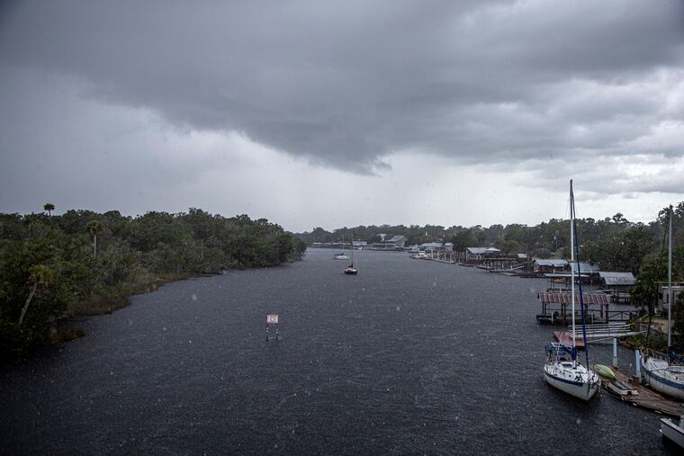
With Ian, a ‘major’ hurricane threat brewing, Florida governor declares state of emergency
The storm is expected to develop rapidly. It could end up affecting much of the East, forecasters say.

With Ian, the first serious hurricane threat to the U.S. mainland in the suddenly revived 2022 season brewing in the Caribbean, Florida’s governor has declared a state of emergency, and forecasters say the storm could have impacts into the Mid-Atlantic region next weekend.
The National Hurricane Center said Saturday that Ian, about 230 miles south of Jamaica with peak winds of 45 mph at 8 p.m., was expected to become a hurricane early Monday, and intensify dangerously before making landfall either on the Florida west coast or the Panhandle at midweek. It noted that computer models have been shifting the track westward.
Florida Gov. Ron DeSantis said he issued the declaration to persuade Floridians to take “timely precautions.” The hurricane center advised “residents in Florida should ensure they have their hurricane plan in place. NASA on Saturday postponed Tuesday’s scheduled launch of the Artemis I moon rocket at Cape Kennedy in deference to the Ian threat.
While the path of Ian remains uncertain, and the forecast track is likely to undergo quite a few shifts before landfall, AccuWeather forecasters said it was possible that Ian eventually could have impacts in the Mid-Atlantic region. As for whether it would affect the Philly region, the National Weather Service Office in Mount Holly said it was unclear, citing “considerable spread in model guidance.”
Ian is still new to the tropical storm roll call, having received its name at 11 p.m. Eastern Friday. Several hours earlier the hurricane center declared that Tropical Storm Hermine had formed in the far eastern Atlantic — bringing to four the number of named storms actively swirling at the time in the Atlantic Basin, which includes the Caribbean Sea and the Gulf of Mexico.
Hermine is forecast to have a short and forgettable career, but Ian is expected to enter warm waters and an overall combustible environment, forecasters said, and could rapidly intensify into a major hurricane with winds of 115 mph or better before approaching the Florida west coast by midweek.
» READ MORE: Another busy Atlantic hurricane season is likely, forecasters say
Ian’s development had been slowed in part because of Hurricane Fiona, which was churning the North Atlantic like a washing machine, and made the Jersey Shore waters hostile to bathers. The National Weather Service warned that “entering the surf will be strongly discouraged.”
Why all the hubbub over Ian?
“It is a big deal,” said Paul Pastelok, hurricane specialist with AccuWeather Inc. “This thing can go really fast and catch people off-guard,” becoming an evacuation-time issue.
Pastelok likened it to Hurricane Delta in October 2020, when the Atlantic hurricane season exhausted the alphabet.
According to the hurricane center, in just 36 hours Delta jumped from an unnamed storm with 34-mph winds to a major hurricane with peak winds of 138 mph.
Delta eventually spun northwest in the Gulf of Mexico, making landfall in Louisiana. While it’s too soon to know this storm’s future path, it’s at least possible that Ian could follow a similar track, Pastelok said. And AccuWeather says the storm ultimately could affect the Mid-Atlantic region.
Fiona effect
It took awhile for Ian to reach name status in part because of Fiona, said Philip Klotzbach, hurricane expert with Colorado State University. Shearing winds from Fiona’s outflow circulation had slowed the development process.
Wind shear, strong upper-level winds that limit the rising air that powers hurricanes, has been an issue all season in the Atlantic Basin, which includes the Caribbean and Gulf, a big reason why forecasters have pared down their robust preseason storm-number forecasts.
Klotzbach and Pastelok attribute that to a high-atmosphere system known as a tropical upper-tropospheric trough — or TUTT — a source of strong upper-level winds from the west that has had both drying and shearing effects on would-be storms.
Saharan dust in the upper atmosphere also has been a factor. Whatever the reasons, not a single storm worthy of a name, one with winds of 39 mph or better, formed from July 3 through August, the first time that happened in 81 years.
» READ MORE: If you’re wondering what happened to that hyper-busy 2022 hurricane season, forecasters say wait
TUTT no longer king
That TUTT system has backed off, “at least in the Caribbean for the time being,” said Klotzbach, and the Atlantic season has been staging quite a rally.
All symptoms late Friday afternoon were pointing to Ian becoming a potent storm.
The dry air along the storm’s potential path has been routed, said Pastelok. “There’s nothing in the central and western Caribbean,” he said, “and the waters are really warm.”
It is beyond too early to tell precisely where it will wind up.
» READ MORE: Florida hurricanes present and past, and 'disaster amnesia'
“Some models take it into the Gulf of Mexico and have it linger there, while others take it across Florida quickly and up the Eastern Seaboard,” Klotzbach said.
The only certainty, however, is that the forecast track is going to undergo changes, some perhaps radically.