A Union County couple are making interactive maps of small-town Pennsylvania. See towns evolve over time.
Floating Maps are available for approximately a dozen small towns in Pennsylvania.
Reading a map, understanding its topography, and using it to find a destination were once a necessity for world explorers and families looking for a campground in the mountains.
No one ever fully learned to refold a map and today, with a host of navigational devices and trail guide apps in our phone, few people use them at all. Maps might seem like an unlikely venture for Kevin and Megan Langdon, but the Lewisburg, Union County, couple started a business earlier this year that combines nostalgia and a love of history with “augmented reality” technology.
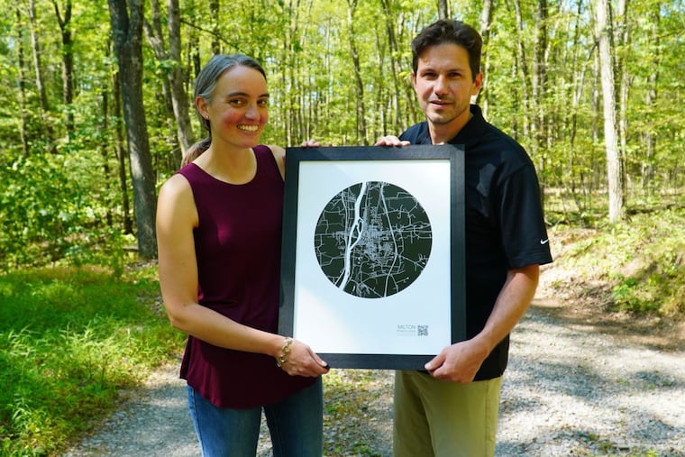
Floating Maps, their company, offers customers a printed map of small Pennsylvania towns. On the list are Lewisburg, their hometown, along with Danville, State College, Lake Augusta, and several others. In recent days, they added Media, Delaware County, to the list. Those maps have QR codes, however, that open an app, turning a simple, decorative wall hanging into an interactive tour through that town’s history.
“This all started because we wanted to build a rug that had contours of our property on it,” Megan Langdon told The Inquirer.
Kevin Langdon found old aerial photos taken by government agencies to document forest growth. Those aerial surveys were repeated every decade or so for about the last century and Kevin found that each new survey revealed how those towns had evolved. Viewers will see heavy train traffic come and go, and towns expand to accommodate industry. In Danville, a city along the Susquehanna River in Montour County, riverside mountains rise up in the Floating Maps app.
“State College is one of the first ones we made,” Kevin said. “What makes it interesting is you can see how much the area exploded in growth over time. It was just a farm town with a little college, surrounded by forest.”
Kevin, a tech entrepreneur who “started a few different companies,” said he digitized those aerial photos with a program he developed, then “stitched” them together over the earliest map. He said it takes about a day to build each town’s interactive map.
While the Langdons once lived in Philadelphia’s Fairmount section, they’ve stuck to building maps of small towns. Philadelphia has had minimal forest cover for centuries, Kevin said, so there’s less aerial footage available. The couple said they do have plans to build maps of areas and rivers city residents would be familiar with.
Megan, a substitute teacher, and Kevin, who once worked for Comcast, have three children and moved to Lewisburg to be closer to family. Floating Maps, they said, isn’t their main source of income but they feel expansion into other small American towns is nearly limitless.
Floating Maps begin at $12.
