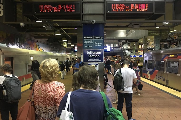
SEPTA service back to normal after disruptions caused by severe thunderstorms in the Philadelphia region
Severe thunderstorms passed though the area late Wednesday — beginning with the evening rush — stranding commuters, knocking over trees, and causing localized flooding.

Service on SEPTA’s Regional Rail Lines is back to normal after severe thunderstorms passed though the area late Wednesday — beginning with the evening rush — stranding commuters, knocking over trees, and causing localized flooding.
During the height of the storms, SEPTA reported widespread service disruptions, and for a while halted service on several of its Regional Rail lines because of weather-related problems, forcing thousands of commuters to seek alternative ways home.
Shortly after 8 p.m., SEPTA spokesperson Andrew Busch said service was gradually resuming across the suspended lines: Chestnut Hill East, Fox Chase, Glenside Combined, Lansdale/Doylestown, Manayunk-Norristown, Warminster, and West Trenton Lines.
“Everything is running, just very slowly,” Busch said.
The Norristown High Speed Line was operating with delays because of flooding, the transit agency said.
SEPTA said Thursday morning it had resumed normal operations and it reported no major problems.
Peco in the meantime was dealing with scattered outages that saw more than 1,600 customers still without power Thursday morning.
A train of another type had developed in the atmosphere, said Sarah Johnson, a meteorologist at the National Weather Service in Mount Holly — one consisting of thunderstorms. Pop-up storms “quickly evolved into a training line,” she said. “Unfortunately it set up right over the 95 corridor, including Philadelphia.” Rainfall amounts of up to 4 inches were reported, she said.
Flooding affected towns in the eastern and southern portions of Montgomery County, said Todd Stieritz, public affairs coordinator for the county’s Department of Public Safety. Since 4 p.m., he said, six cars had to be pulled from a flooded road in Lower Merion; one in Whitemarsh, and one in Lower Moreland. Downed trees struck two cars on Sumneytown Pike near North Wales, the weather service reported.
Tree limbs more than a half-foot in diameter came down in Tullytown, Bucks County, where a wind gust of 63 mph was measured.
In Delaware County, the flooding was widespread, with severe rainfall snarling traffic in Haverford and Newtown Square, according to a county official. In Chester County, there were no immediate reports of water rescues or major flooding disasters yet, said Bill Turner, director of the Office of Emergency Management.
The government’s Storm Prediction Center said a volatile environment “will support multi-cell clusters and lines capable of both large hail and damaging winds” and it issued a severe storm watch until 9 p.m. A more-imminent severe thunderstorm warning was issued shortly after 4 p.m., saying “60 mph wind gusts and penny size hail” were possible.
In North Jersey, a confirmed tornado with estimated winds reaching 70 mph briefly touched down shortly after 2:45 p.m. in Springfield, Union County, the National Weather Service reported.
The storm center said shortly after noon on Wednesday that storms already were firing up in the Mid-Atlantic and Northeast.
“Some storms will produce damaging wind gusts and localized flash flooding,” the National Weather Service said in a hazardous weather outlook statement Wednesday morning.
“These could be a little more dangerous than earlier ones this summer,” said Jim Eberwine, a meteorologist who is an emergency coordinator at the Jersey Shore.
The impending weather prompted the cancellation of a number of outdoor events, including a Natalie Prass concert at Haddon Lake McLaughlin-Norcross Memorial Dell in Haddon Heights.
After pounding the I-95 corridor, the storms made their way east to the Jersey Shore.
» READ MORE: New Jersey and Delaware beaches: What’s open, what’s closed
There is a chance of showers and thunderstorms Thursday morning before skies clear later in the day.
The weekend weather forecast looks promising with sunny skies and daytime highs in the mid-80s Friday, Saturday, and Sunday.
Staff writers Anthony R. Wood , Joseph A. Gambardello, and Robert Moran contributed to this article.