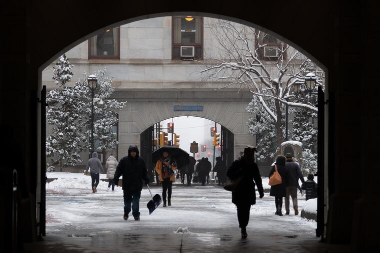
Region shut down ... by forecast more than the snow
Up to 4 inches of snow fell across the region on what already was a snow day for much of the region. The forecast also had an impact.

It wasn’t as though yet another nuisance storm in this winter of incremental snowfall largely shut down the region Wednesday afternoon. The forecasts had already had taken care of that.
Evidently, businesses, schools, highway departments, and SEPTA learned something from the fiascoes of a surprise snowfall last Nov. 15 that resulted in hundreds of accidents and evening commutes that were memorable for the wrong reasons.
By the time this snow yielded to a light freezing drizzle late in the day, most of the brave folks who had ventured to work evidently made it home safely. Some freezing drizzle persisted into the evening, as cold air was more reluctant to surrender the lower levels of the atmosphere than computer models had foreseen, but it was not causing major icing problems.
Still, road conditions had deteriorated rapidly late Wednesday morning, and numerous traffic accidents were reported, including one in which two people were killed shortly after noon in Pemberton Borough, Burlington County. Other crashes occurred on Route 422 and I-95 in Pennsylvania, the Pennsylvania Department of Transportation said.
And SEPTA was forced to detour bus routes and cancel some Regional Rail runs.
When all was said and done, more than 175 flights in and out of Philadelphia International Airport were canceled, among more than 2,200 nationwide, according to FlightAware, as wintry conditions affected broad areas in the eastern half of the country.
But with forecasters on Tuesday having called for two to five inches of snow the following day, for hundreds of thousands in the region Wednesday was a snow day before the first flakes started falling, with many schools closed.
Some businesses also shut, while others let employees go home early, and SEPTA decided to fast-forward the evening commute by implementing its “Early Exit” schedule at 1 p.m.
Consequently, the number of roadside assistance calls was “very light” in early afternoon, a symptom of low traffic volume, said Jana L. Tidwell, spokesperson for AAA Mid-Atlantic.
“The commuter rush evidently started early,” said PennDot spokesperson Chelsea Lacey-Mabe. “So that really helped. Our plows were able to get the work done.”
Almost as if it were taking orders from meteorologists, the snow started about 9:30 a.m. Coincidentally, that was almost the exact time that the snow started back on Nov. 15, but this time around, the region caught a few more breaks.
Aside from the fact that forecasts generally were close to the money — snowfall totals of up to four inches were reported in Chester and Delaware Counties — nature also was more helpful, said Chad Shafer, a meteorologist with the National Weather Service in Mount Holly.
“The timing of the event wasn’t the worst possible for rates of accumulation,” Shafer said.
Even though temperatures were below freezing, the snow had to fight the late February sun, which exerted an influence though it spent the day in hiding. Had it started before daybreak, more snow likely would have covered paved surfaces.
“It could have been worse,” he added.
Whatever is on the ground Thursday morning won’t be around long. And the sun will really be showing off its power on Friday, when temperatures are predicted to crest past 50.
March is notorious for volatile weather, but thus far the winter of 2018-19 hasn’t lived up to some of the robust seasonal outlooks.
Officially, about 15 inches has been measured at Philadelphia International Airport, not too far below normal for a Feb. 20. But it has fallen with the ferocity of frozen-water torture. The biggest snowfall of the season remains the 3.6 inches of Nov. 15.
“The pattern we’ve been in has been pretty stable,” said Shafer. “That’s why we’re getting systems that look and feel the same.”
The Climate Prediction Center’s 8- to 14-day outlook favors a return to below-normal temperatures, but AccuWeather meteorologist Alan Repert says above-normal to normal readings should be the rule for the next several days.
The opposite is the case on the other end of the country.
“We’re seeing a lot of cold storms in the West,” Repert said. A “potent and cold” low pressure system was expected to drop up to three inches on the outskirts of the normally parched West by Friday morning, the National Weather Service said. Heavy snow was predicted for northern Arizona.
That’s not uncommon; typically when it’s cold out that way, it’s warm around here.
On Sunday, forecasters promise it will be quite warm around here, with a high in the mid-60s.
Staff writers Joseph A. Gambardello, Oona Goodin-Smith, and Robert Moran contributed to this article, which contains information from the Associated Press.