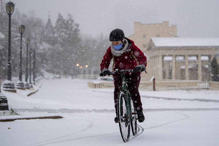
Philly’s white Christmas prospects: Is this the year the drought ends?
The pattern is looking favorable for cold and storms this week, but Christmas snow is always a long shot.

Thursday’s coastal storm was a clinic in why a white Christmas is so often a dream deferred around here.
It was a potent nor’easter, the kind that can impose a snowy interdict on the Washington-to-New York corridor — but not often in December.
After the precipitation got underway Thursday, along with copious moisture, the storm’s onshore winds imported warm air inland from the Atlantic Ocean, where the sea-surface temperatures were around 45 degrees at midweek. The snow didn’t have a snowball’s chance.
Ocean temperatures in the mid-40s are about normal for December, just one factor arguing against a white Christmas, which the government loosely defines as an inch of snow on the ground at daybreak on Dec. 25.
Plus, even though the sun doesn’t get any lower, the average high in Philly for Dec. 25 is 44, and temperatures during the month typically go above freezing on 28 of the 31 days.
» READ MORE: This was one very white Christmas
In any given year, according to the National Centers for Environmental Information, Philly has a mere 9% chance of meeting the white Christmas criteria.
But it has happened, most recently in 2009, when better than two feet of snow fell atop the region during a solstice mega-storm. A foot accumulated on Dec. 24-25, 1966.
And this year, snow could beat the odds. Computer models are seeing the best shot at snow during the holiday season “in many years,” Judah Cohen, a scientist with the Atmospheric and Environmental Research, in Massachusetts, observed last week.
What’s happening up there
The upper-air patterns are aligning in such a way that cold air is forecast to pour into the contiguous United States, with below-normal temperatures expected across the eastern two-thirds of the nation until well after Christmas, the government’s Climate Prediction Center says.
In addition, a frisky storm traffic is forecast to develop from the moisture-rich Gulf of Mexico to the Atlantic Coast, suggesting the potential for more nor’easters.
Only this time, more cold air could be entrenched as the storms track up the coast. However, snow still would be a long shot.
About nor’easters
Storms form along the boundaries of contrasting air masses, and with Arctic air sliding off the continent and interacting with the warmer air overlying the Atlantic, the East Coast of the United States is one of the world’s major breeding grounds for winter cyclones. That was quite a surprise to the early European settlers.
Some of them stay too far offshore or too far south to affect Philly. When they come closer, almost anything can happen.
» READ MORE: Computer models don't always know when it's going to snow
Winds circulate counterclockwise around centers of storms, and as coastal storms migrate northward, areas to the north and west of the center can experience strong, moisture-laden winds off the ocean. That can shake the snows from the skies, but cyclones that travel closer to the land are prone to throw mixed precipitation or rain back upon Philly.
» READ MORE: The magic and mystery of snow persist in a warming climate, a book excerpt
A famous example was the Christmas winter storm of 1776, when Gen. George Washington crossed the Delaware, and his troops marched several miles through a punitive wintry mix. Philadelphia experienced about 10 inches of snowfall. Meanwhile, Thomas Jefferson — a weather nerd’s weather nerd — reported two feet of snow in Monticello, well away from the coast in western Virginia.
Why do we care?
Evidently no one particularly gave a musket ball about whether Christmas was white, gray, or green in 1776.
The concept gained traction in the 19th century, although any logic would fall well short of explaining why it has such a hold on the popular imagination, although a newspaper had a lot to do with it.
It got a cosmic jolt from a poem — which had disputed authorship but was credited to a professor named Clement Clarke Moore — that conjoined snow and Christmas.
The “Account of the Visit of St. Nicholas” first appeared in 1836 in the Troy, N.Y., Sentinel. It has become more commonly known as “‘Twas the Night Before Christmas.” Embellishing the Dutch tradition of St. Nicholas’ delivering gifts on his Dec. 6 feast day, the writer added reindeer and a sleigh, which, of course, would require a friction-free frozen surface.
And in 1836, snow at Christmas would have been more common in this country. That was near the end of the “Little Ice Age,” an era dating to the Renaissance when Europe, northeastern North America, and perhaps other parts of the planet were significantly colder.
The Christmas-snow coupling was permanently cemented with Bing Crosby’s rendering of Irving Berlin’s “White Christmas” in Holiday Inn, released in 1942.
One might wonder what a Manhattan Tin Pan Alley denizen like Irving Berlin might know of “sleigh bells ringing in the snow.” It turns out that he might well have had personal experience.
Video from 1898, when Berlin would have been about 10, shot by Thomas A. Edison Inc. and now in the possession of the Library of Congress, shows horse-drawn sleighs dashing through the snow in Central Park.
And who knows: Snow might cover Central Park and Rittenhouse Square this Dec. 25. But keep in mind, that would be a long shot.