Schuylkill River Park adds two sections
"We want to keep the wildlife," Joe Syrnick said, standing in a dreary field of weeds near the east bank of the Schuylkill.

"We want to keep the wildlife," Joe Syrnick said, standing in a dreary field of weeds near the east bank of the Schuylkill.
As he gazed toward the river with its tangles of scrub and trees, a tawny dog bounded over a rise, then stopped and stared, concerned by humans invading his isolated jungle territory.
"Oh, yeah, there are feral dogs in here, but they're not a problem," said Syrnick, executive director of the Schuylkill River Development Corp. "They've never attacked us."
On one side of the dog, just past the weedy tree line, the river flowed. On the other, beyond a chain-link fence and a hillock, trucks pushed and pulled and organized vast amounts of the city's garbage.
Such is a future parkland setting in Philadelphia.
In a year, if all goes as planned, the garbage haulers will surely remain, but weedy field, invasive shrubs, and wild dogs will be replaced by a three-quarter-mile sweep of greensward and asphalt pathway - the newest portion of the Schuylkill River Trail park and path, currently running south from Montgomery County through the city and stopping at Locust Street.
Two new parcels, amounting to about 12 acres, have been acquired and deposited with Fairmount Park by Syrnick's organization, which is charged with reclaiming as much of the riverfront as possible for use by city residents.
At its last public meeting before closing down for good after 142 years, the Fairmount Park Commission accepted both parcels. It was virtually the last act of the commission, created in 1867 to acquire land, particularly industrial land along the Schuylkill.
The first new river parcel, where Syrnick spotted the tawny dog, is known as Dupont Crescent. It runs roughly from the 34th Street-University Avenue Bridge, under the Grays Ferry Avenue Bridge and on to Wharton Street in a small neighborhood known as Forgotten Bottom.
This parcel, which traces a sharp bend in the river, is located behind the DuPont Marshall Laboratory, a research facility noted for development of vehicle coatings and paint. (DuPont plans to close the lab this month, with the loss of some 265 jobs.)
The city acquired a ribbon of DuPont riverfront about 200 feet wide, much of it contaminated by heavy metals from paint testing. Syrnick's group cleaned up the toxic areas last fall and is now prepared to create a strip of parkland stretching behind the DuPont lab building and the Waste Management trash-interchange site next to it.
The second of the new parcels will extend the river trail from its current terminus at Locust Street to South Street. But the sliver of land between the existing CSX railroad tracks and the river quickly narrows south of Locust, forcing a radical design solution to keep the trail going: Syrnick's group will build a 2,000-foot boardwalk out into the river, connecting to the rebuilt South Street Bridge by ramp. The boardwalk will be 15 to 17 feet wide, with overlooks extending even farther out into the river.
Syrnick says the DuPont Crescent section of what the development corporation has dubbed Schuylkill Banks will cost $3 million. About $500,000 has already been spent on hazardous-materials cleanup. That section will be bid this summer and could be completed by the end of next summer.
While DuPont Crescent will be accessible from the 34th Street Bridge and from Wharton Street, the trail will exist as a disconnected strip, a forlorn lozenge flanking an industrial desert, at least for awhile.
The boardwalk to South Street will be much more costly - roughly $10 million - and more difficult to complete.
Syrnick said that he hoped for some state funding, but that the project is not, as they say, shovel-ready yet. The new South Street Bridge, however, scheduled for completion in late 2010, has a trail ramp integrated into its design, and Syrnick hopes that will help push for completion of the boardwalk. No one, he believes, wants a ramp to nowhere.
At South Street, the trail will have to cross over to the west side of the river for the simple reason that the eastern bank of the river is still in active use by Peco.
On the west side of the river, the Schuylkill Expressway blocks access to the water. Syrnick believes a route can be found near the river, perhaps along a little-used service road.
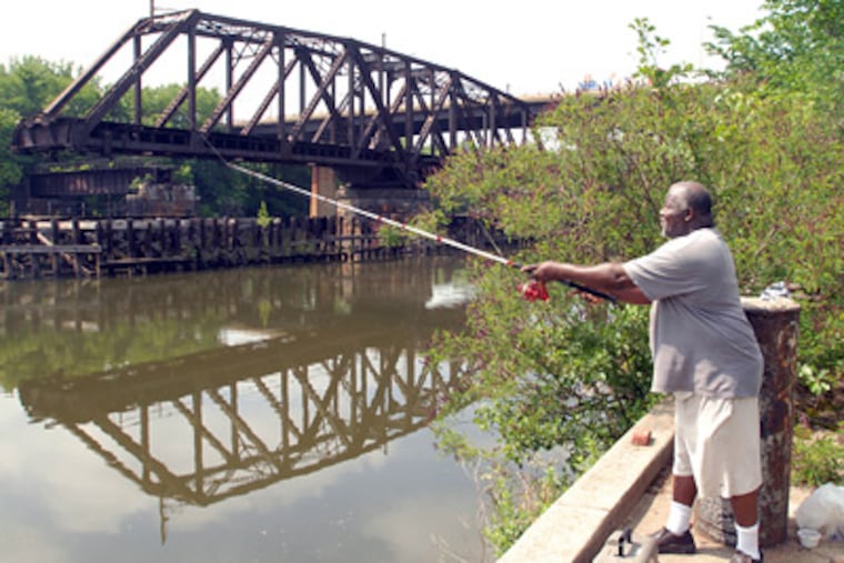
At 34th Street, the trail would cross back over along the existing bridge to the eastern bank, run down to the DuPont property and around the crescent on the newly acquired land. Just past the Grays Ferry Bridge, where an abandoned railroad swing bridge already exists, the trail would cross back over to the west bank and run down to Bartram's Garden.
"That's where you want to be," said Syrnick. "It sounds like a lot of crossing over the river, but guess what - that's what's cool about it.
"We've got seven miles to go to the Delaware River," he said. "It's not possible to build [the trail] in order. So we say when you get it, build it, and if there's a gap, that will create an urgency to close that gap."