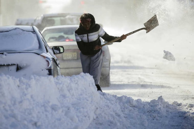
Zero hour? Philly has shot at hitting the Big 0 for first time in 24 years
Officially, the temperature hasn't hit zero in Philly since Jan. 19, 1994. It might happen Sunday.

With one more day of stinging winds and subzero wind chills ahead, Philadelphia is likely to set temperature records Saturday and Sunday morning, and might even experience a frigid rarity.
Temperatures are forecast to plunge to zero in areas outside the city Sunday morning, and the National Weather Service said the official reading at Philadelphia International Airport will come tantalizingly close. The city hasn't had an official zero-or-lower reading since Jan. 19, 1994, when it went to 5 below.
"It's our best shot that we've had in some time," said Dean Iovino, a National Weather Service meteorologist in Mount Holly, who was around the last time it happened.
Regardless of that, Saturday's forecast high of 16 is likely to set a record for the lowest maximum temperature for a Jan. 6 — 18 degrees, set in 1942 — and Sunday's predicted low of 2 degrees would beat the 4 recorded in 2014.
The wind-chill factor dropped to zero at 11 p.m. Thursday, according to the Weather Service, and won't reach a positive number until 10 a.m. Sunday.
But forecasters say the chill that has flash-frozen much of the eastern half of the country is about to relent. Informal surveys indicate that it will not be missed.
On the East Coast, this has been a week of rarities, in which frozen iguanas rained out of trees in Florida and a "cyclone bomb" buried the Jersey Shore under a season's worth of snow, turned parts of Georgia into a winter wonderland, and flooded streets in Boston.
That storm has continued to spin off the coast of Nova Scotia and has been working in tandem with a weather system to the west to import dangerously frigid air.
Locally, the freeze forced school closings and government shutdowns, and forced SEPTA on Friday to resort to a Saturday schedule, producing cattle-car crowding on some Regional Rail lines during the peak commuting period.
More than 45 flights in and out of Philadelphia International Airport were canceled and more than 55 were delayed.
After this weekend, the extreme cold is going to go on winter break, forecasters promise. Temperatures will reach well into the 30s on Monday, and the government's two-week outlook is calling for above-normal temperatures. Iovino said the outlook for later in the month has a gentler look.
But before then, the city could break its 24-year zero drought.
Why has it lasted so long?
The world and the region have grown subtly warmer in the last few decades, and 2017 almost certainly will have been one of the Earth's warmest years in records dating to 1880.
The zero drought might be unrelated to that trend.
First, this isn't the longest wait for a reading of zero degrees in Philly. That distinction still belongs to the period from Jan. 13, 1936, to Feb. 2, 1961 – 25 years.
One reason for the rarity of that reading relates to where temperature measurements have been taken.
Up until 1940, they were taken in the midst of the Center City heat island, before the measuring site was moved to the airport, which is next to the Delaware River and near a swamp.
One reason it might happen Sunday morning is that the cold spell has yielded a harvest of ice in the vicinity of the airport. In addition, the measuring site now sits above a generous snow cover. Snow is the great reflector of daytime solar heat. The skies should be clear, and the loss of heat from the surface is more robust when the sky is cloudless.
The critical component Sunday morning would be the winds; the calmer the better for hitting zero. A lack of wind is ideal for allowing surface heat to radiate into space. The forecast for early Sunday calls for winds of 5 mph or less.
It's too bad that won't be the case Saturday, as winds of up to 25 mph and near-gale-force gusts continue.