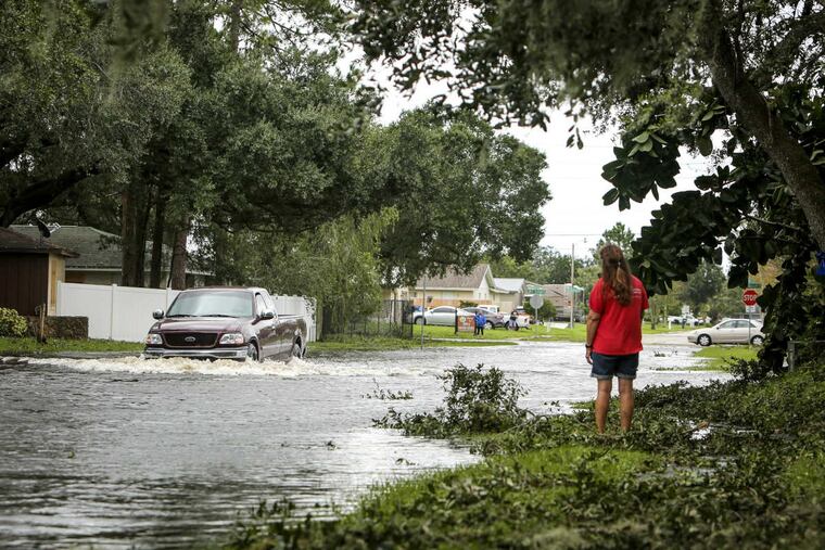
Irma's final phase: Flooding in the Southeast is biggest concern
This storm, while wounded, is still dangerous.

Irma weakened to a tropical storm Monday morning and is expected to further weaken by Tuesday to a tropical depression. But this storm, while wounded, is still dangerous. Both storm surge and inland flooding, which cause the majority of deaths in tropical cyclones, remain a risk over the Southeast states.
At 11 a.m., Irma was centered 70 miles east of Tallahassee, with peak winds of 65 mph. It was plowing to the north-northwest at 17 mph toward southwest Georgia.
In addition to the flood risk over the Southeast, tropical-storm-force winds and hurricane-force gusts were possible over a large area from North Florida through eastern Alabama, much of Georgia and southeastern South Carolina. These winds could bring down trees and cause power outages.
Tornadoes could also spin up in coastal areas from northeastern Georgia to southeastern South Carolina, where a tornado watch was in effect.
Storm surge risk
Water levels will continue to be elevated above normally dry land along parts of the Gulf and Atlantic coasts from Central Florida to coastal South Carolina. A storm surge warning extended over these areas, and the National Hurricane Center warned Monday that "life-threatening" coastal inundation remained possible.
In areas where peak surge coincided with high tide, water levels were predicted to rise as much as 6 feet above normally dry land from the northeastern Florida coast to the central South Carolina coast on the storm's Atlantic side, and from near Clearwater, Florida, to the state's Big Bend area on the Gulf of Mexico side.
The National Weather Service reported that storm surge flooding in Jacksonville set a record Monday morning as water covered downtown streets.
Surge flooding also occurred in Charleston, South Carolina, on Monday, reaching its worst around high tide midday Monday. "Avoid Downtown Charleston, roads already closing across the city," the Weather Service tweeted.
Inland flood risk
Rain covered the entire state of Georgia and all but the most northeastern part of South Carolina on Monday morning. In many areas, the rain fell heavily.
"Intense rainfall rates of 2 inches or more per hour is leading to flash flooding and rapid rises on creeks, streams, and rivers," the National Hurricane Center said.
Flood warnings covered much of eastern Georgia and northeast Florida on Monday morning.
The heaviest rainfall is expected to focus over southern and central Georgia and southern South Carolina on Monday.
"Significant river flooding is possible beginning Monday and Tuesday in much of central Georgia and southern South Carolina where average rainfall of 3 to 6 inches and isolated 10 inch amounts are expected," the hurricane center said. "Portions of these states within the southern Appalachians will be especially vulnerable to flash flooding."
Later Monday and into Tuesday, the heaviest rain will spread north and west into northern Georgia, the western Carolinas and Tennessee, as well Alabama and northern Mississippi. In these areas, the NWS predicted 2 to 4 inches of rain and locally higher amounts. The service also cautioned that local flooding could occur.
Through Monday morning, widespread rainfall totals of 6 to 10 inches were reported over the Florida peninsula, with pockets of 10- to 15-inch totals.
Some of the 10-inch-plus totals fell over population centers such as Naples, Fort Myers, Melbourne and Fort Pierce.