After snowfall, record-breaking warmth could be on the way
The snow will fall fast before the system passes around midnight.

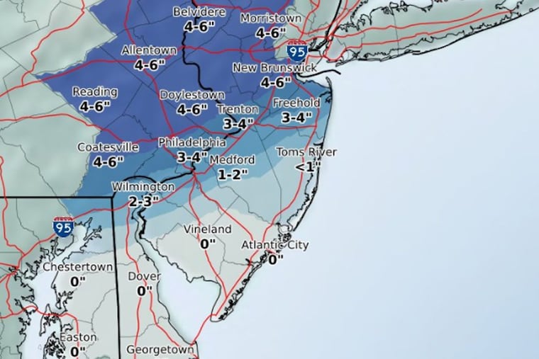
A fairly speedy storm could dump up to an estimated 4 inches of snow on the Philadelphia area by midnight, the National Weather Service in Mount Holly said Saturday evening.
But don't be too grouchy if you have to clear snow off your car Sunday morning, or even shovel and salt the sidewalk. Record-breaking warmth could be on the way Tuesday and Wednesday.
The snowflakes started falling at Philadelphia International Airport by about 5:30 p.m. Saturday, although heavier snow already had been reported in Northampton County.
"It's going to be a very fast-moving system," NWS meteorologist Sarah Johnson said. "Through the evening hours, we could see some heavy bands."
That means the snow accumulation may be as much as an inch per hour this evening, with the snow tapering off around midnight, Johnson said.
Don't expect the snow to linger.
"During the day tomorrow, we expect temperatures to be well above freezing," said Johnson, probably in the mid- to upper 40s, with sunshine chasing away early clouds.
Monday may bring showers, with temperatures in the 40s, possibly even low 50s.
But on Tuesday and Wednesday, "We're looking at possible record-breaking highs" in the 70s, Johnson said.
The record for Feb. 20 was 70 degrees in 1939, and 72 degrees on Feb. 21 in 1930, she said.
The rest of the week, the weather will be relatively mild, with temperatures in the 50s and 60s. But more precipitation may be on the way.
"We have another storm system that could move in next weekend," Johnson said.