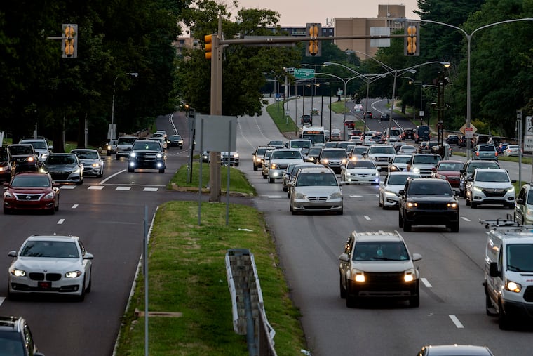
Imagine a safer, greener, better Roosevelt Boulevard — with or without a subway
Roosevelt Boulevard began as a rural parkway. One option for its 2040 future would turn it into a neighborhood-centric parkway with lower speeds, green spaces and bike lanes.

Over the last two years, a long-mothballed proposal to build a Roosevelt Boulevard subway has fired many people’s imaginations and won backing from business and political leaders in Northeast Philadelphia.
Others say it’s a wild dream.
But it’s one of the options under consideration as city transportation planners, PennDot, and SEPTA are asking for residents to help decide how to revamp both the 12-mile super roadway itself and SEPTA service on the corridor.
Four open houses are scheduled in the Northeast and Lower Bucks County through December and into January, where people can examine displays of the various options, where people can ask questions, make comments, and fill out a survey. The first is Saturday at 10 a.m. at the Mayfair Community Center.
“This is a project that affects one in three Philadelphians,” said Matt Wysong, coordinator of the Roosevelt Boulevard Program at the city’s Office of Transportation and Infrastructure Systems, known as OTIS.
The three transportation agencies will whittle down options to a short list, based in part on the public feedback, along with technical analysis. The goal: Choose one preferred alternative and, ideally, have the changes in place by 2040.
Connecting Northeast Philly
Supporters pushed for the subway to be included in the study as one of the potential transit solutions, and its inclusion is one indication of how the idea has gained momentum.
“We want the most rapid transit times and the safest ride,” said Jay Arzu, a doctoral student in urban planning at the University of Pennsylvania and chief advocate for the proposed subway. He noted that unlike the other two transit options — a light rail line or an enhanced Bus Rapid Transit system — a subway connected to the Broad Street Line would neither conflict with surface traffic nor require a transfer.
Northeast Philadelphians, he said, “deserve a one-seat ride” to Center City. Often slow bus transit has annoyed the area’s residents for some time, and one of the goals of the 2040 vision is faster service.
It’s about more than the subway, though. The idea is to rebuild a roadway that is greener, easier to navigate and safer for pedestrians, bicycle riders, and drivers alike, in addition to better connecting the Northeast to the rest of the city via transit.
Two options for the roadway are in play. One is a partially capped sunken highway with local surface roads on either side — think Vine Street Expressway, only with more green space on the caps.
The other, a “neighborhood boulevard” concept, a wide street with lower speed limits for local traffic and parklike space. Wysong, of OTIS, compared the latter concept to the Ben Franklin Parkway.
PennDot pegged the low-end cost for the subway at $11.6 billion, if it were paired with a roadway alternative called the “neighborhood boulevard,” a wide street with lower speed limits for local traffic and green space.
But Arzu said that cost assumption is too high because PennDot based it on using a boring machine to dig a tunnel down the middle of the street. Using a subway construction technique called “cut and cover” would drop the cost from $900 million per mile to about $400 million per mile, Arzu said.
He bases his argument on research analyzing the monumentally expensive Second Avenue Subway project in Manhattan by New York University’s Transit Cost Center.
In the cut-and-cover method, sections of prefabricated tunnel are placed in a trench and covered over with soil. Though cheaper, it is said to cause more disruption during construction.
Arzu said he questions whether PennDot is “trying to sandbag the [subway] project or make it look unlikely.”
Not so, the city’s Wysong said.
“I don’t think we have a horse in this race,” he said. “We just want to go through this process methodically and transparently and arrive at something that is a combination of different ideas and meets the project goals.”
Evolving travel needs
Of course, any option chosen has to be “buildable from a funding standpoint,” Wysong said.
But that doesn’t mean it’s just a pencil on paper, or clicks on a GIS program, exercise.
“We’re asking folks to imagine their future selves, and not just them, but the other people in their lives … and how their [travel] needs are going to evolve and change over the next decade plus,” Wysong said.
Roosevelt Boulevard has received high-level attention in the last two decades. A 2003 report by the city planning department recommended building the subway, while a 2021 Route for Change planning document choose a Bus Rapid Transit option for the transit piece.
Meanwhile, work to improve the Boulevard is underway and scheduled for completion by 2029. Unlike the 2040 reimagining, that work is fully funded, including with a $78 million federal “mega grant” won last year.
Among those tweaks is an overhaul of intersections on Roosevelt Boulevard, such as extending the pedestrian crossing timer from 90 seconds to 120 seconds, as well as using curb “bump outs” and medians to shorten the distances pedestrians need to cross.