Flood warnings up for the Jersey Shore, and don’t blame the rain
A sea-building storm off the southeast coast is stirring up waves, setting off the flooding, meteorologists say.
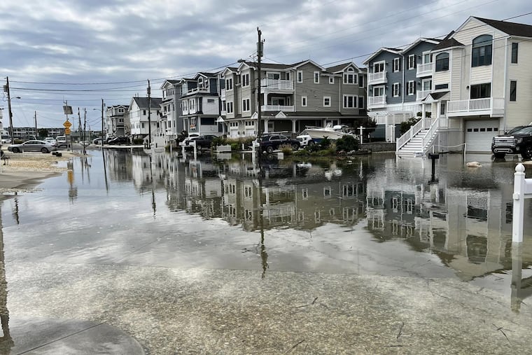
The vegetation at the Jersey Shore may be justifiably moisture-starved, but for the last few days some of the water-clogged streets have been turning Venetian, and that trend may continue into Monday.
After several days of nuisance flooding in the beach towns, the National Weather Service on Saturday issued a coastal flood warning for Cape May County, in effect through 5 p.m. Sunday.
In addition, flood advisories are up for Cape May and Atlantic Counties through 5 p.m. Monday.
Significant road flooding was evident Saturday in Sea Isle City, Ventnor — where high waters forced the closing of the Dorset Avenue Bridge during the afternoon — and elsewhere.
What explains the flooding in a month when the Atlantic City Airport has recorded all of 0.07 inches of rain — as in 3% of normal — and just about the entire Philadelphia region has been designated “abnormally dry” by the interagency U.S. Drought Monitor?
And it’s not as though the winds have been howling off the ocean.
» READ MORE: Rising seas threaten a Rutgers research station
The Tuesday night “super moon” — one of the moon’s closer approaches of the year — may have had some effect on tidal tug earlier in the week. But the prime agent behind the flooding this weekend likely has been a storm meandering off the southeast coast, said Jim Eberwine, the Absecon emergency manager and alumnus of the Mount Holly National Weather Service Office.
While the onshore winds haven’t been especially impressive, the storm has been building the seas for days, he said.
Said Scott Homan, a meteorologist with AccuWeather Inc., the storm’s persistence has driven large offshore waves toward the beaches.
In areas under the flood warning, the weather service says, “numerous roads may be closed” and flooding might affect some homes and businesses.
As for those in the advisory areas, expect to find water on the usual-suspect roads, with partial or full road closures possible in beach and bay towns.
That nuisance storm that is out to sea is due to sag southward, reducing the flood threat early in the week, but rain deficits look to continue.
Showers are possible Tuesday night into Thursday night, but nothing drought-crushing, said Joe DeSilva, a meteorologist in the Mount Holly office.
» READ MORE: Forecasters had warned of a possible record hurricane season, but so far ....
Noticeably absent this month have been downpours from tropical storm remnants, a substantial source of precipitation in Septembers past — sometimes too much.
But in what forecasters warned might be a historically busy hurricane season in the Atlantic Basin, the tropical storm numbers have been well below normal to date.
For Philadelphia-region rains, the ones that have formed have been “either weak or too far away.”
Homan said that a Gulf storm could bring some rain toward the end of the workweek, although that’s hardly a done deal.
While we certainly could use the rain, not too much, please.