Winds howled, but the rains came late, the tornadoes stayed away, and Philly avoided Debby’s worst
Debby took a more westward track and picked up speed, sparing Philly the worst. The weekend is expected to be gorgeous.
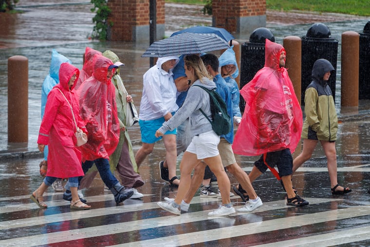
Heavy rain bands finally invaded the Philly region Friday afternoon, just in time for the late-day commute, and with winds gusting past 40 mph at times, as many as 25,000 power outages were reported in Southeastern Pennsylvania and South Jersey, along with a harvest of downed trees. Some places flooded.
However, after awaking to a battery of end-of-the-world warnings and advisories following one wild night in the life of the atmosphere, the Philadelphia region escaped the tornadoes and the worst of the mayhem from what was left of erstwhile Hurricane Debby.
The extreme downpours, flooding, and water rescues were occurring well to the west of the region Friday in the likes of York, Dauphin, and Juniata Counties, while along I-95, not much in the way of rain had occurred after daybreak Friday, and at times the sun even appeared.
» READ MORE: Live coverage of Debby in the Philadelphia region
Debby-related impacts included more than a half foot of rain in northern Delaware and Burlington County, and one EF-1 tornado with top wind speeds of 95 mph in New Castle County on Thursday night.
As for Friday, flood warnings went up for parts of Bucks and Montgomery Counties, and advisories for nuisance flooding along the Delaware River. The back bay areas of Ocean County also experienced flooding as winds from the south pushed up the Barnegat Bay waters.
Those wind gusts across the region exceeded 40 mph in some places. Philadelphia International Airport reported 83 canceled flights and 428 delays.
But Philly has had many worse days courtesy of storms without names. When the rains finally arrived in the region, in all likelihood some commuters got caught in downpours, this being a summer Friday, when the evening rush tends to begin earlier — for reasons that bosses don’t need to know. But the downpours didn’t last long.
» READ MORE: We've had a lull since the 2020 abd 2021 season, the region was affected by six tropical remnants
That said, “We were pretty lucky here,” said Lee Robertson, the observing-program coordinator with the National Weather Service office in Mount Holly, which has been inundated with spotter reports the last few days.
Why Debby’s impacts Friday were not as bad as forecast
» READ MORE: What looked like an outlandish forecast early in the week, worked out in some places
Debby’s remains stayed well within the National Hurricane Center forecast cone, however its core entered Pennsylvania slightly west of the predicted trajectory, putting Philadelphia on the fringes and away from the heaviest, steady rains, said Alyssa Glenny, a meteorologist with AccuWeather Inc.
The wind forecasts did work out as the Debby remnants interacted with a front pressing southward.
Winds circulate counterclockwise around areas of low pressure, and with the core of Debby’s remains to the west, the Philly region was getting winds from the south that were getting an extra kick from the increasing forward motion of the northward-moving core of the storm.
Debby-related rains, however, were lottery-ball situations.
On Thursday, for example, 6.31 inches of rain was measured in Bear, New Castle County, the weather service reported, with over 4.51 inches in Coatesville, Chester County.
By contrast, just 1.5 inches was measured in West Chester, about 18 miles away. The official total Thursday at Philadelphia International Airport was an unimpressive 1.1 inches.
Similar randomness was evident Tuesday night into early Wednesday when more than half a foot was reported in the Delran, Burlington County, area, and a less impressive 1.6 inches at PHL.
Rain totals in Philly were kept down Friday by the fact that by the time the showers reached the region, Debby’s remains were accelerating northward with a strong nudge from the approaching front, said Robertson.
As opposed to Thursday, Robertson said, “We didn’t get as much training” — the meteorological term for thunderstorms that cluster and get stuck in place.
What’s ahead for the Philly region in Debby’s wake
Come Saturday, you might think you’ve moved. The sun will be all but unobstructed, the winds will have died down and the atmosphere will be drying out, meteorologists are promising.
That will be followed by a sequence of days uncharacteristic of the Dog Days of Philly, with comfortable temperatures in the 80s and low humidity.
Staff writers Beatrice Forman and Rob Tornoe contributed to this article.