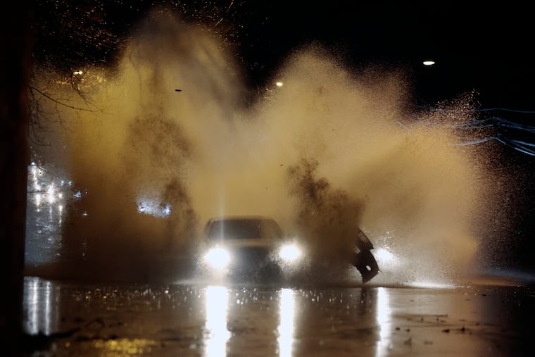
Storm brings downpours and a trace of snow to Philly area, but the region also caught a break
The recent dryness probably kept the floods from being worse, meteorologists say. And about that White Christmas ...

Flooding downpours from a potent storm that inundated much of the Northeast and left over a foot of snow in parts of northern New England on Sunday gave the Philly region its most generous soaking in three months — but thank October for the fact that the impacts weren’t far worse.
Rainfall totals locally ranged from 1.5 to 4 inches as a powerful front crossed the region, spawning a coastal storm and importing colder air that led to several inches of snow in the Poconos and snowflake sightings all the way to Philadelphia International Airport.
The winds weren’t quite as ferocious as expected on Sunday, meteorologists said, but the front did generate winds gusts up to 50 mph at the Shore, and winds picked up on the mainland on Monday.
But the rains arrived and persisted pretty much as advertised, with much of it falling in spurts. “It was a good, juicy system,” said Dave Dombek, senior meteorologist with AccuWeather Inc.
The fact that the region had a bone-dry October — a mere 0.27 inch recorded at Philadelphia International Airport — and slightly below-normal rains in November, worked to the region’s advantage, Matt Brudy, a meteorologist at the National Weather Service Office in Mount Holly, said Monday.
“That really saved us,” he said.
Dombek concurred: “No doubt,” he said.
» READ MORE: An 'atmospheric river' of moisture was the the rains' supplier
On a night when the weather was about as miserable as Eagles’ fans, the downpours resulted in a number of road headaches. By the time the storm pulled away, flooding rains had caused lane restrictions on I-95 near the Betsy Ross Bridge, in Tinicum Township, Delaware County, and in northern Delaware; on the Schuylkill Expressway near Route 202 in King of Prussia and near Belmont Avenue; on Route 1 in Bucks County; and on Route 130 in Camden County.
As cold air surged eastward, rain changed to snow with several inches also falling upon parts of Upstate New York, and a foot or more in northern New England. Some of that snow made its way to the region, with a Chester County site reporting 1.5 inches.
Officially, a trace was observed at Philadelphia International Airport. It was Philly’s fourth trace of the season, but if you’re counting, it now has been 681 days since Philly saw its last inch of snow.
» READ MORE: Forecasters say it really will snow at some point in Philly this winter
That total will be going up, and according to the latest Climate Prediction Center forecast, the 700 mark isn’t out of reach.
Temperatures the rest of the week aren’t expected to get out of the 40s, but while it may feel more like Christmas, no snow is imminent.
The climate center’s eight-to-14 day outlook, which includes Dec. 25, favors above-normal temperatures for virtually the entire contiguous United States. The lone exception would be the southern half of Florida, where the snowbirds would be wise to keep the umbrellas handy.
The chances of an inch or more of snow around here on Christmas in any given year are less than 10%, by NOAA’s calculation. In 2023, said Dombek, they might be less than that: “It’s a small number.”