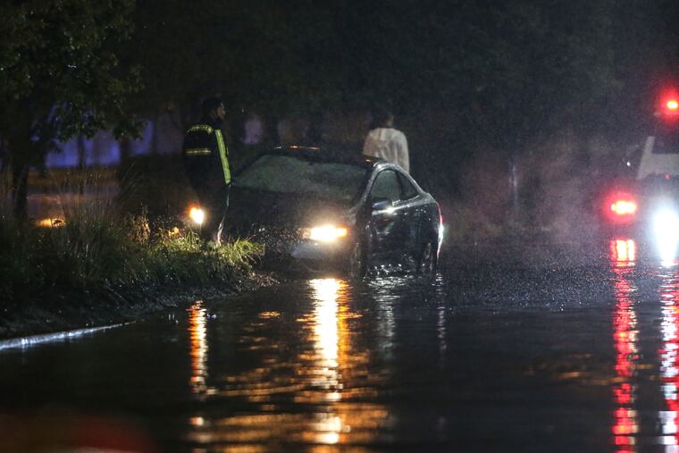
‘Heavy flooding’ from the Delaware River reported on Columbus Boulevard from Washington Avenue past Spring Garden Street
A flood warning was in effect for the Shore Saturday. But the rains will back off and Halloween is looking splendid. Will we see the northern lights?

“Heavy flooding” swamped Columbus Boulevard from Washington Avenue north past Spring Garden Street Friday night, police reported, and on a day when winds gusted to past 60 mph, a storm that wasn’t properly a nor’easter pulled off quite a convincing impersonation of one.
“Taken by itself this would be just a kind of a run-of-the-mill good soaker,” said Dave Dombek, senior meteorologist at AccuWeather Inc.
But the Delaware River was still digesting the upstream deluges from earlier in the week, and Friday night it reached reach a near record crest at the Washington Avenue gauge.
Shortly before 9:30 p.m., police announced they were closing the I-95 ramp at Washington Avenue as result of the “heavy flooding” on Columbus Boulevard.
Police tried to block traffic onto and along the boulevard, but some motorists using side streets found ways to roll through the water and a few got stuck. No injuries were reported.
There were reports of flooding throughout the surburbs and the Camden County Police Department announced that Admiral Wilson Boulevard was closed in both directions because of high water.
Peco reported around 8,000 customers were affected by outages, with nearly half being in Montgomery County.
» READ MORE: A timeline of Ida's Philly destruction
The weather service said moderate flooding along the river was possible late Saturday, and the flood warning for the Shore continues through 9 p.m. Saturday.
Moderate tidal flooding was occurring along the Jersey coast, particularly in the back-bay areas, and a corridor of heavy rain Friday evening set off flood advisories from Chester County to the Jersey cape.
Tropical-storm force gusts were reported at the Shore and on the mainland, with a gust to near 45 mph in Delaware County and 62 mph at the Shore. Given that the winds were from the east — as opposed to prevailing winds from the west to which trees are more accustomed — and the sogginess of the soils, Peco officials were concerned about potential power outages, and over 12,000 reported Friday evening.
But flooding was the primary concern.
The Delaware River gauge at Washington Avenue is reached 10.4 feet at 8:36 p.m., the weather service said, just shy of the record crest, 10.6 feet. That was higher than the one generated by the remnants of Ida. The National Weather Service flood warning was in effect until 1 a.m. Saturday.
The winds and rains were associated with a sprawling storm or area of low pressure that was centered in the Ohio Valley interacting with high pressure, or heavier air, to the north of Philadelphia. The region caught in an air sandwich, as heavier air rushed into the lighter surrounding air, similar to what happens when a tire is punctured.
The rains and winds were due to back off by the early-morning hours, and the region was due to start drying out Saturday.
» READ MORE: A solar storm might make northern lights visible near Philly Saturday night
It’s possible that enough clearing could take place for a rare opportunity Saturday night: Space-weather forecasters say there’s a chance that thanks to a solar storm, the northern lights might be visible over the region.
Whether that does or doesn’t happen, nothing is scary about the splendid Halloween forecast.
Under cloud-free skies and light winds, temperatures are expected to be around 60 degrees around the witching hours Sunday.
That’s almost precisely where they should be on an Oct. 31.
Inquirer staff writer Robert Moran contributed to this article.