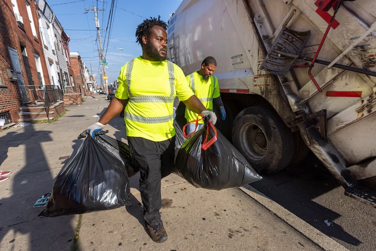
Philly heat is about to retreat after 3 days of triple-digit heat indexes
Temperatures might actually fall below normal in Philly by week's end. Meanwhile, officials are discussing long-term changes in heat-alert language and one city is even naming its heat waves.

This enervating broth of an air mass really is about to give it up. But save for the fact that the day was about two minutes shorter than its predecessor, Tuesday could have passed for a summer rerun of Monday.
It hit 97 in Philly on both days. So, why did the National Weather Service end up posting an “excessive heat warning” Tuesday for much of the region, and just a “heat advisory” the day before?
The distinction was technical. By 10 a.m. Tuesday it was evident that the heat index in Philly was going to reach the warning criterion — 105 degrees for two consecutive hours — said Trent Davis, meteorologist at the Mount Holly Office. And it did. On Monday, it topped out at a mere 103.
If your body couldn’t tell the days apart, chances are excellent that you had company. (The weather service upgrade did not affect Philadelphia’s heat emergency, in effect since Sunday.)
» READ MORE: Philly finished with its second-warmest July on record; August didn't miss a beat
“I don’t think the average Joe knows the difference between an ‘advisory’ or a ‘warning’ or a ‘watch,’” said Laurence Kalkstein, a retired climatologist who helped Philadelphia develop its heat-response system in the 1990s. He added that even though weather-service officials have made admirable efforts to explain the system to the public, “It goes over people’s heads.”
Wording remains a work in progress: Kimberly McMahon, the public weather services program manager, said the agency is “advancing efforts to simplify its messaging for heat products.”
Thankfully that messaging probably won’t be needed for the next several days. Temperatures might stay below 90 on Wednesday, and true relief is due on Thursday. By week’s end the region might experience that summer of 2022 rarity — days with temperatures below normal. We’ve had only six of those since July 1. It might even rain most everywhere late Wednesday into Wednesday night.
This being August, however, with fall still six weeks away, you very probably wouldn’t lose money betting on another round of heat alerts.
Someday, those might look quite different.
Name that heat wave?
The weather service is looking at “a few initiatives” to determine if the heat index is “the best way” to convey the dangers, said Sarah Johnson, the warning coordination meteorologist in Mount Holly.
They include using the more comprehensive “Wet Bulb Globe Temperature,” an index that takes into account air temperature, atmospheric moisture, cloud cover, solar angle, and winds.
Under the auspices of the Arsht-Rockefeller Foundation Resilience Center, Kalkstein has developed a different warning system, which is getting a test drive in Seville, Spain. In what has been a brutally hot and deadly summer, Seville has gone so far as to become the first city in the world to name heat waves. (It started with “Zoe,” since Seville decided to work backward in the naming alphabet.)
That is unlikely to happen in this country any summer soon. The weather service, McMahon said, “does not name heat waves.”
Naming aside, Kalkstein developed a three-tier system based on air-mass conditions, temperatures, and a complex formula that attempts to calculate potential mortality. One factor in the equation is the weather within the previous 30 days, on the theory that heat is less dangerous when people are acclimated. Philadelphia’s heat-wave death total stands at six, and the fact that none have been reported since last week may be related to the July heat.
Kalkstein said that Athens, Greece, and several U.S. cities are participating in the Arsht-Rockefeller pilot program, in which a Level 1 alert would be for a heat wave with a minimal number of heat-wave deaths. The risk increases at Level 2, and a Level 3 would be issued only for the top 10% of heat waves.
The forecasts are kept current automatically with weather-service updates and available to the participating cities.
While climate change has raised fresh concerns about heat hazards, Kalkstein said he prefers to separate the heat and global-warming discussions.
“Right now, heat is deadly,” he said. “We don’t care what it’s due to. We have to do something about it.”
See you next heat wave
Nature is about to do something about this particular heat.
A succession of cold fronts is about to attack that “Bermuda high,” the one that has been smothering the East with hot winds from the south. It got up to 96 all the way to Montreal on Monday. It also temporarily again chilled the waters at the Jersey Shore, where the surf was down to 55.9 Tuesday morning.
Showers are possible late Wednesday into Thursday, and this time they actually might be widespread, said the weather service’s Davis. “We haven’t really had any cold fronts that have brought widespread thunderstorms and rain to the whole area.”
» READ MORE: New Jersey declares a drought watch, asking residents to conserve water
About half the region is in the U.S. Drought Monitor’s “abnormally dry” zone, and New Jersey is under a statewide drought watch. Dryness has contributed to the heat by allowing the sun to bake the ground rather than divert energy to evaporating water. Tuesday marked the 34th time this year Philly’s temperature had reached at least 90.
For those who have about had it with the heat, time and climatology are on your side.
» READ MORE: Leaves are falling, but fall is still six weeks away
The daily “normal” highs and lows have slipped a degree. They now are “down” to 87 and 69, respectively. The sunsets are getting earlier; the nights, subtly longer; the fireflies are turning off the lights, and the birds are getting quieter.
The autumnal equinox occurs at 9:03 p.m. Sept. 22.