‘Microbursts’ pounded South Jersey on July 4th, and Philly heat may have been a factor
Heat coming off steamy Philly may have given the storms an extra kick.

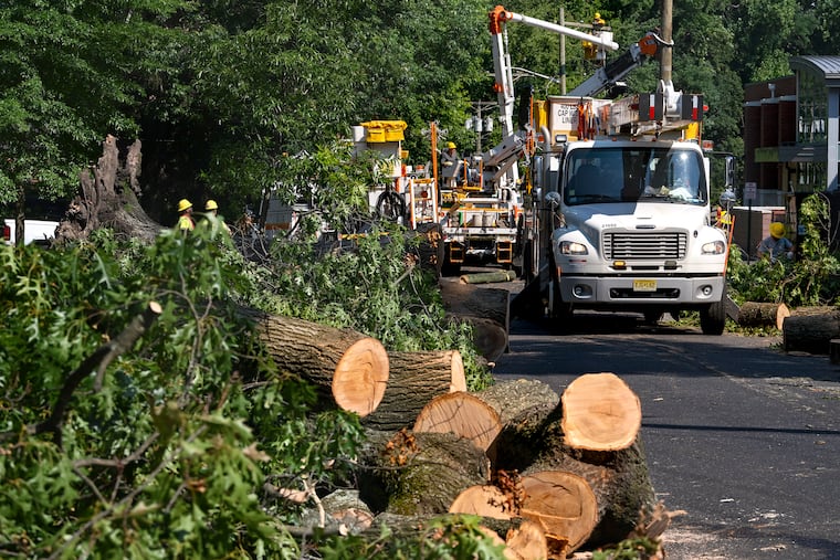
Those destructive winds and rain that cascaded violently from the skies like powerful waterfalls over a portion of Camden and Burlington Counties on Tuesday were generated by thunderstorm “microbursts,” the National Weather Service said Wednesday.
And radar images suggested the potency of the responsible thunderstorm may have been related to the urban heat cooked by the sun and the paved surfaces of the city, said Ray Martin, a meteorologist with the Mount Holly National Weather Service.
“It almost looked like it was feeding off the heat coming off Philadelphia,” he said.
No injuries or deaths were reported, but the weather service logged multiple reports of flash flooding, closed roads, downed wires, and felled trees in a relatively confined area that included Cherry Hill, Haddonfield, Marlton, and Mount Laurel, beginning about 5:30 p.m.
“It was a series of microbursts,” Martin said.
» READ MORE: The heat from Center City’s buildings and streets might be giving the rains a little extra juice
About microbursts
Martin said that conditions were ideal for a potent thunderstorm to form in South Jersey late Tuesday afternoon. Thunderstorms form from warm air rising over cooler air and condensing into water droplets. In this instance, with no “shearing winds” to block it, the air was able to rocket skyward almost unimpeded.
“You need the energy to get the core of moisture really high into the clouds,” he said. When the updraft relents for whatever reason, he said, all that liquid just goes “plop, which is what the microburst really is.”
» READ MORE: A microburst can do tornado-like damage
It’s “simply a mass of moisture that just decides to drop all at once. So that creates a huge pulse of wind at the surface.”
The process was repeated multiple times Tuesday as the parent thunderstorm more or less stalled in place for up to 90 minutes in the languid steering winds.
Typically, such a storm affects areas only within about a 2.5-mile radius, according to NOAA, and the mayhem was confined to northern Camden and western Burlington Counties.
Philly connection?
If the water-vapor broth brewing over Philly was a factor in the Jersey siege, Martin said, the evidence suggests it wouldn’t be the first time.
Philadelphia and other highly built areas along the I-95 corridor form a formidable heat-island chain with their sun-absorbing phalanxes of skyscrapers, shopping malls, streets, parking lots, and assorted paved surfaces.
» READ MORE: Microburst thunderstorms aren't new around here, and they'll likely be back
Their impact on temperature is well-known, particularly on nighttime temperatures. Those building and paving materials are reluctant to give up their heat after sunset, and overnight lows in the city can be several degrees higher than in surrounding areas.
In the last 50 years or so, extensive research has established that the heat also may give a kick to storm energy downwind of the heat island, according to J. Marshall Shepherd, a climate specialist with the University of Georgia.
Of note, Philly’s prevailing winds are from the southwest, and it turns out that historically annual precipitation over Trenton, 40 miles to the northeast, has been about 3% higher than what has been measured at Philadelphia International Airport.
Climate change
As for this particular microburst episode, “There’s no connection we can make to climate change,” said Martin.
But he pointed out that the urban heat island is indisputable evidence that humans’ activity indeed can change the climate and weather.