Philly recorded 4 straight days of snow for just the 4th time ever and forecasters expect more to come
The winter of 2020-21 has changed dramatically. So have the forecasts.
The government’s forecast through Feb. 17 has a decidedly “code blue” look for below-normal temperatures in Philadelphia and most of the nation. This is notable in that it comes less than two weeks after that same Climate Prediction Center had called for a mild February across the country.
To paraphrase Mark Twain, if you don’t like the weather forecasts, sometimes all you have to do is wait. For volatility, they can give the atmosphere a run for its money, and that appears to be especially true this winter.
About the only things that seem certain during the next several days are melting snow; black ice; a salt harvest; and, at some point, an Arctic outbreak. Temperatures will peak in the 30s Thursday, and the 40s on Friday, when light snow turning to rain is possible. Some snow Sunday still isn’t out of the question.
“A lot of fight is going on in the atmosphere,” said Bob Smerbeck, a senior meteorologist with AccuWeather Inc., which on Wednesday issued an outlook calling for winter to lap well into March in the Northeast. “That usually causes trouble.”
Smerbeck is aware of how fast things can change. He had said, “The outlook is not good for snow lovers.”
Ten days later, Philadelphia would be having its biggest snow in five years, albeit one of the stranger storms on record, and the culmination of a winter reversal of fortune.
About that snow
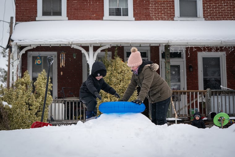
The region is familiar with eight-inch snows; usually they don’t accumulate at the rate of two inches a day.
Snow was measured officially at Philadelphia International Airport on four consecutive days, something that has happened only four times in 136 years of records, said Tony Gigi, former National Weather Service meteorologist.
The official total of 8.1 ponderous inches represented 27 times the amount that fell all of last winter, 0.3 inches.
The seasonal total stands at 14.7, well above the normal for the date. Double-digit totals were common this week in the adjacent counties, with 30-plus inches reported in far northern Bucks County.
Looking at the winter-layered landscape, it might be hard to remember that through last Wednesday, Philadelphia had experienced only two January days with below-normal temperatures and no snow through Saturday.
What changed
The turnabout is related to warming in the upper atmosphere over the Arctic, said Judah Cohen, a specialist in polar meteorology at Atmospheric and Environmental Research, in Massachusetts.
Meteorologists said the warming has resulted in liberating the polar vortex to migrate south to export colder air to the lower latitudes.
In issuing its February outlook on Jan. 21, the government’s Climate Prediction Center did caution that the effects of that so-called sudden stratospheric warming would constitute a wild card.
Conditions in the atmosphere over the Arctic and Greenland have favored snow and cold in the Northeast, said AccuWeather’s Smerbeck. But they have been in conflict with the upper-air patterns associated with the La Niña cooling of waters in the equatorial Pacific, which would argue for milder conditions around here.
Smerbeck said the computer models are not doing a very good of refereeing this wrestling match, thus the forecast volatility.
What’s ahead?
Melting: The sun is feeling its oats. By March 1, it will be twice as strong as it was at the winter solstice, according to Fred House, a retired Drexel University professor.
Black ice: With melting, that liquid ooze turns to invisible ice as temperatures fall below freezing at night.
Salt: It will be on the roads, in the air, and on your boots. With all that black ice, expect crews to be spreading it generously.
More snow and cold: We’ll see.
Any snow that falls Friday, said Sarah Johnson, a lead meteorologist at the National Weather Service office in Mount Holly, would be minor. A previously threatened mega-coastal storm for Sunday had vanished from the models, but Johnson said, “We’re watching it.”
Severe cold, perhaps with single-digit lows, is coming, said AccuWeather’s Smerbeck. It’s just a matter of whether it’s early next week or close to the weekend.
» READ MORE: Groundhog Day 2021: Punxsutawney Phil sees his shadow
Beyond that, the Northeast and Midwest should see “more or less a continuation of winter through the month of March,” said his colleague Dave Samuhel.
Punxsutawney Phil couldn’t have said it better. And if you don’t like that outlook, wait.