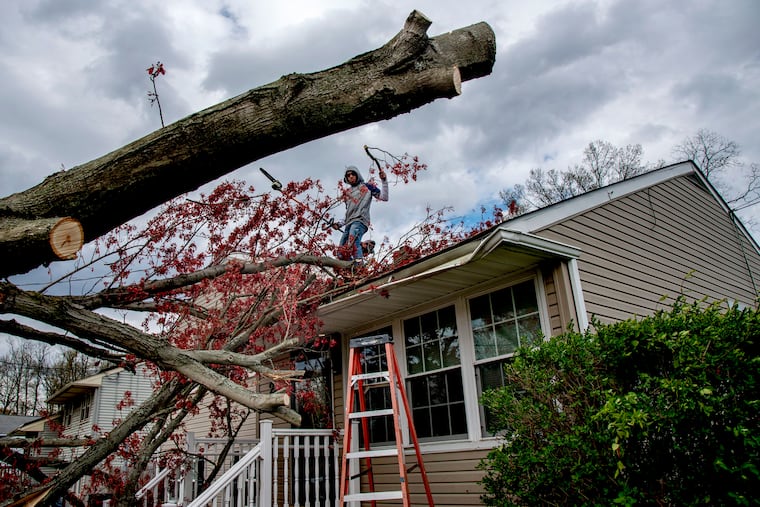
Winds gusting to 70 mph roar through Philly region; power outages widspread
More than 37,000 lost power as a result of the winds; another wind advisory is in effect Friday.

A potent front that roared through the region Thursday set off gusts up to 71 mph, knocking out power to more than 37,000 PECO and Atlantic Electric customers.
The winds are due to back off some Thursday evening, but they are due for encore Friday, and the National Weather Service has posted another wind advisory for 7 a.m. through 7 p.m. period.
Quarter-inch hail was reported in Bucks, Chester, and Montgomery Counties, and the winds also set off hails of natural confetti, as cherry, magnolia and assorted blossoms that popped spectacularly the last few weeks went flying.
Reports of gusts past 55 mph were common Thursday afternoon, with a 71 mph peak wind clocked at Barnegat Light. At the official weather service station at Philadelphia International Airport a 59 mph gust was measured.
At the peak, 31,000 PECO customers lost power, said spokesman Greg Smore, with the city’s collar counties hardest hit. Camden County was the hot spot across the river, said Frank Tedesco, spokesman for Atlantic Electric, which reported 6,100 outages.
“We know how impactful it can be to be without power,” said Smore, “especially these days with everyone staying home.”
The winds could be a harbinger of a frisky period for the region’s weather, forecasters said.
“We certainly have got ourselves into quite an active pattern,” said Sarah Johnson, a lead meteorologist at the National Weather Service office in Mount Holly, where the forecasters are occupying well-separated work stations.
» READ MORE: ‘It’s go time for spring’: Blossoms, buds, and temperatures are popping
No, the weather service does not issue warnings for blossom mini-blizzards, but it has issued a plain old wind advisory in effect until 5 p.m. west of the Delaware River and until 7 p.m. in South Jersey.
The winds should back off for a while Thursday night, as they are wont to do after sunset, “but not as much as we typically see,” Johnson said. They will pick up again and continue into Friday afternoon.
Daytime highs Friday and Saturday won’t get past the low and mid-50s; normal highs are well into the 60s. Easter Sunday is looking sunny, with highs in the mid-60s.
But it appears the weather will deteriorate next week, with more showers and cooler temperatures.
The government’s Climate Prediction Center’s two-week outlook has odds favoring below-normal temperatures for about 70% of the contiguous United States, with chilly, upper-air low pressure in control.
Much of the nation could be locked in a winter-like pattern — which was noticeably missing all winter.
Dave Dombek, a meteorologist with AccuWeather Inc., said that it’s possible that the Philadelphia region could see some, albeit short-lived, snowflakes before the chilly spell ends. “That’s not out of the question,” he said.
Philadelphia’s latest measurable snow occurred on April 27, 1967, 0.1 inches.