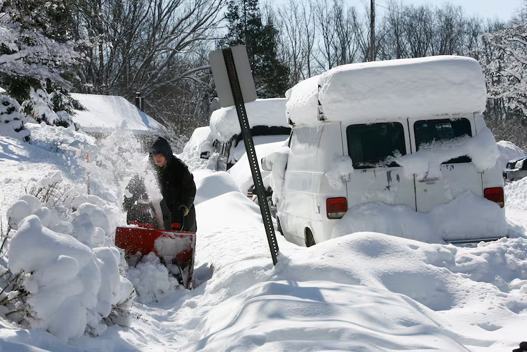
Ten years ago this week, Philly got 44 inches of snow in 5 days. Why this winter is so different.
On this week 10 years ago, an all-time snow siege began in Philly. A record 78.7 inches fell that winter. This year? A therapy dog situation for snow-lovers.

The blitz began on a Friday evening, and it didn’t waste any time accumulating in the yards and on the roads. But perhaps even more astonishing than the 28.5 inches measured officially when the snow stopped was the fact that a piggyback mega-snowstorm was right in its wake.
By the time all the snow was over, 44.3 inches had fallen on Philadelphia — more in some places nearby — in 5½ days, from Feb. 5 to 11, 2010. Nothing in the period of record, dating to 1884, or in the available anecdotal evidence preceding it, has rivaled what happened that week around here.
The other 34.4 inches that fell in that winter of 2009-10 season would by itself have finished among the top 20 snowiest winters in Philadelphia, which for one season mutated into Syracuse, N.Y.
This winter? It might be a therapy dog situation for snow-lovers.
“They’re hurting puppies,” said Louis W. Uccellini, head of the National Weather Service, an acknowledged snow-lover, and one of the nation’s leading authorities on winter storms.
If nothing else, the 0.3 inches that have fallen this season underscore the folly of trying to predict precisely how much snow will fall in a given winter. Snowfall along the I-95 corridor is about as predictable as the average boss’ behavior.
» READ MORE: No one lives at the airport. So why is Philly’s snowfall measured there?
Seasonal snow forecasting would be so much easier if the big ones, which can make all the difference in winter totals, were periodic, said Uccellini, but they are “inherently episodic.”
And if not rare, at the very least they have been more than unusual. In their Northeast Snowstorms, Uccellini and meteorologist Paul Kocin identified just 35 major storms along the Washington-Boston corridor over a 40-year period.
“The fact that snow comes so infrequently has such a huge interannual variability,” said David A. Robinson, the New Jersey state climatologist and an expert on snow matters.
Why isn’t it snowing now?
The most significant difference between the winters of 2009-10 and 2019-20 isn’t so much in the bare ground in the Northeast as the upper atmosphere over the North Atlantic, said Uccellini.
» READ MORE: After April-like weather in Philly, a soggy week ahead. Is ‘time running out’ on winter?
The atmosphere is what the scientists call a nonlinear chaotic system, and multiple factors affect where it does and doesn’t snow.
But the career of the so-called North Atlantic Oscillation (NAO) is pretty much the ball game for Northeast snow, says Uccellini. And that’s a major forecasting headache.
The NAO is measured by an index of pressure differences between the Arctic and latitudes near Philadelphia’s.
When the pressures in the high latitudes are higher, and the air heavier, the cold air that is the sine qua non for snow tends to pour into the Northeast, and the storm tracks favor coastal snowstorms that can get a kick from cold air interacting with the warmer sea surface.
When the index is positive, cold air is prone to shun the Philadelphia region.
The NAO was insanely negative in the winter of 2009-10. It has not been negative for any winter month since February 2013.
This winter, driven by the NAO, cold air has tended to pass north of Philadelphia, scoot across the Atlantic, and winter in Europe. “Iceland has been very cold,” Uccellini said.
But knowing how the NAO affects the atmosphere is way easier than predicting its behavior.
Why is the NAO so hard to predict?
For one thing, said Uccellini, it is not an oscillation: “It doesn’t really oscillate, it changes rapidly.” It is not predictable beyond several days.
It is not like the El Niño/Southern Oscillation in the tropical Pacific, in which a continent-size patch of sea surface becomes unusually warm for months and affects the jet stream winds that carry weather to the United States.
The ocean has a greater attention span than the atmosphere.
And the NAO is “an atmospheric pattern. It’s driven from the top down.” It’s affected by the stratosphere, which is several miles deep. “We don’t have much data there,” he said.
As for figuring out precisely what in the atmosphere governs the NAO, Uccellini said: “That’s the big research question.”